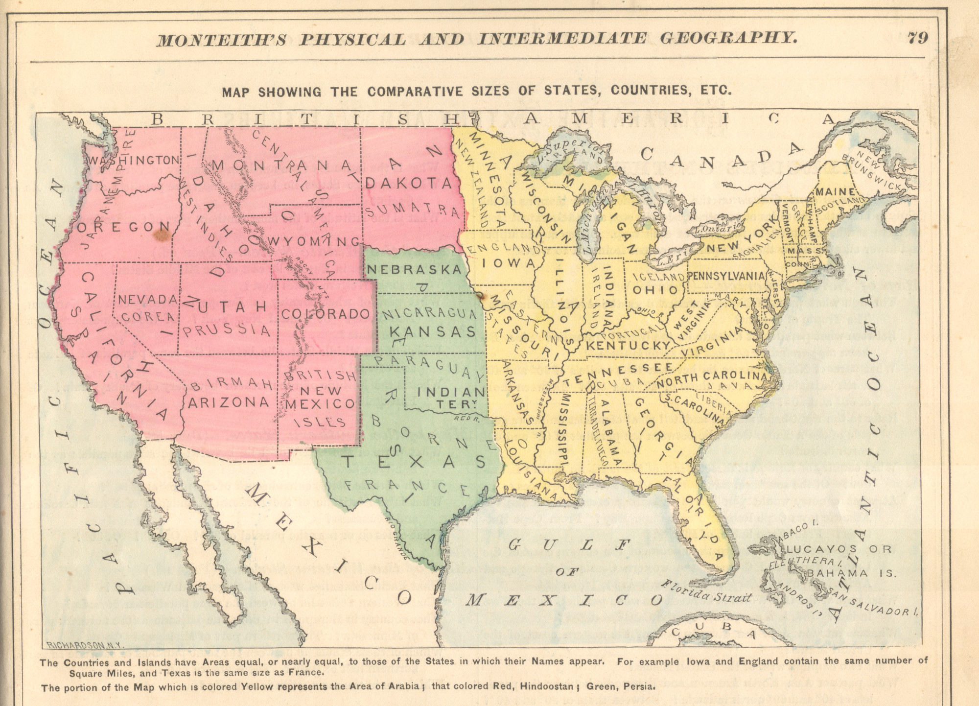
James Monteith’s textbooks make a lot of inventive efforts to help geography students understand comparative area on maps (read more about that here). This map is from the first half of Monteith’s career, circa 1869, and predates his use of state outline area symbols set into a map. This map is playful, creative, effective, and ahead of its time in many ways.
Jeff Patton mentions this map briefly in an article about nineteenth century in a 1999 article for Cartographic Perspectives.