I have long been a great fan of Richard Edes Harrison, both for his cartography and his writing about what he called “the geographic sense.” I have collected several copies of his Look at the World: Fortune Atlas for World Strategy and framed some of his maps, but I am always excited to find a lesser-known work of Harrison’s. In recent years I have stumbled upon the advertising maps he did for the Consolidated-Vultee Aircraft Corporation, and some maps for a book on the Battle of the Atlantic.
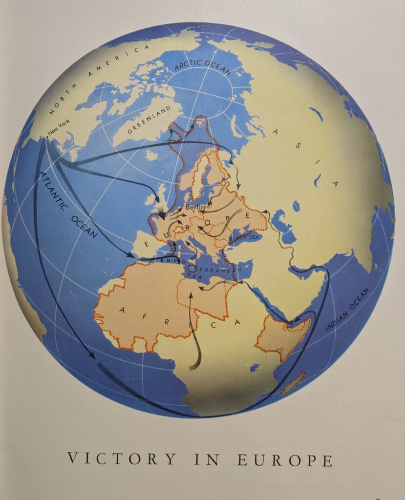
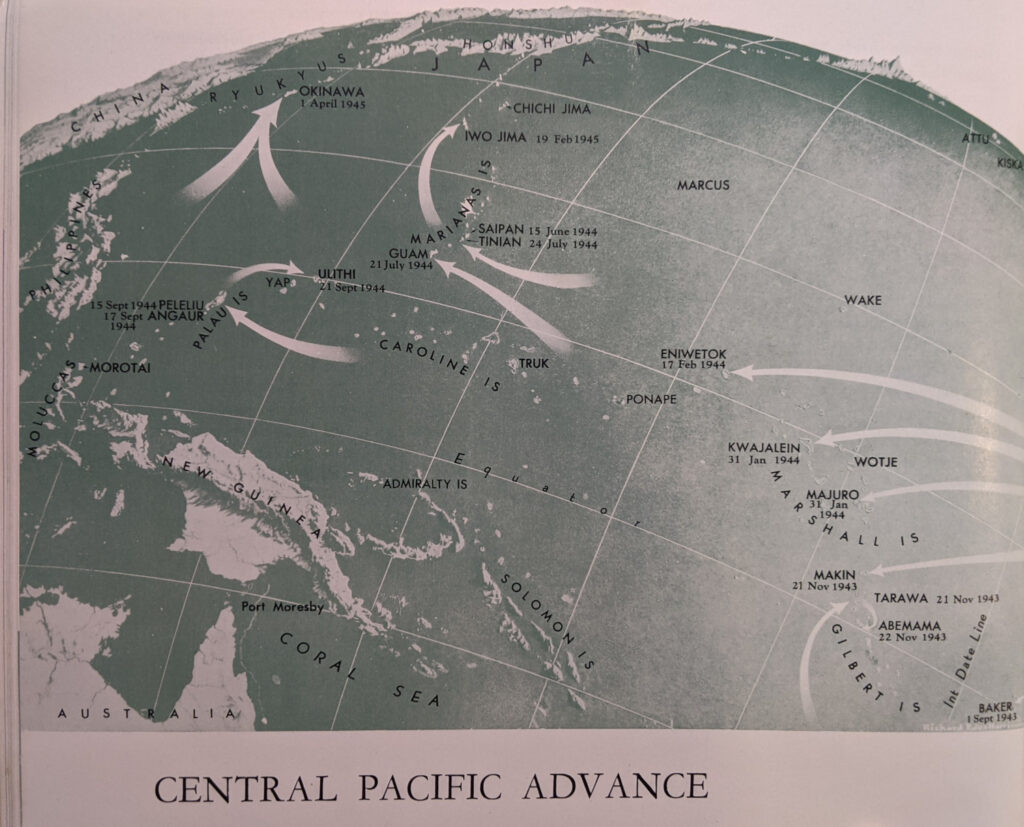
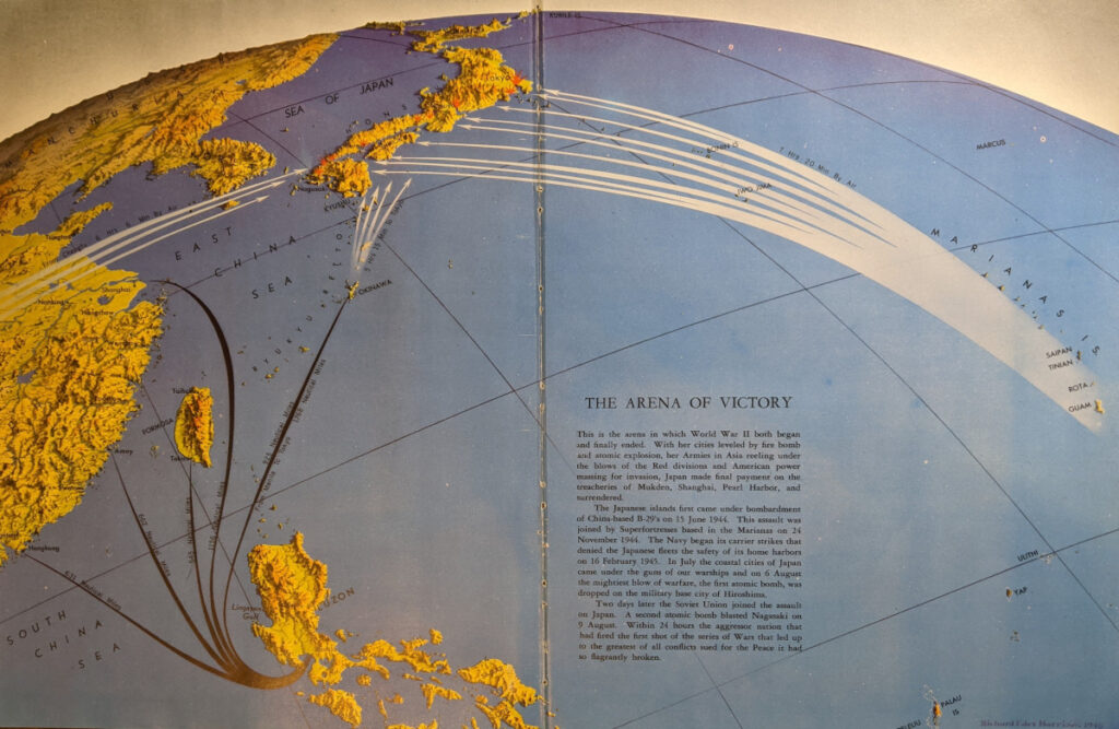
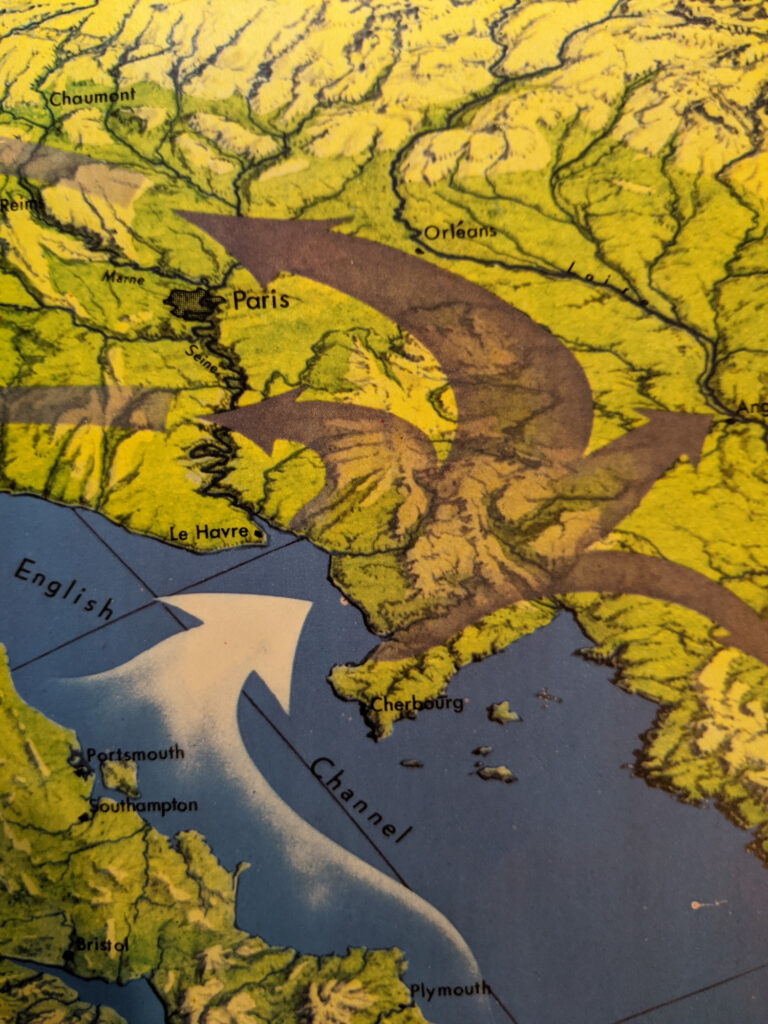
However, I was amazed to discover the collection of his maps in the Simon and Schuster edition of General George Marshall’s 1945 report on The Winning of the War in Europe and the Pacific. I bought a copy online because of a passing reference that it might include a Harrison map. But as it turns out, it contains dozens of Harrison maps, some of them two-page color maps and some of them small black-and-white maps. Some of the maps are reprints from Fortune, while others are original for the text.
A full atlas of Harrison maps in a book available on the cheap online is a great find for a collector. But I am also thrilled with what a great example the book is of combining clear, concise writing about strategy with innovative and compelling cartography. The combination of Marshall and Harrison in this book is exactly the type of effective communication called for in “Thinking in Space.”