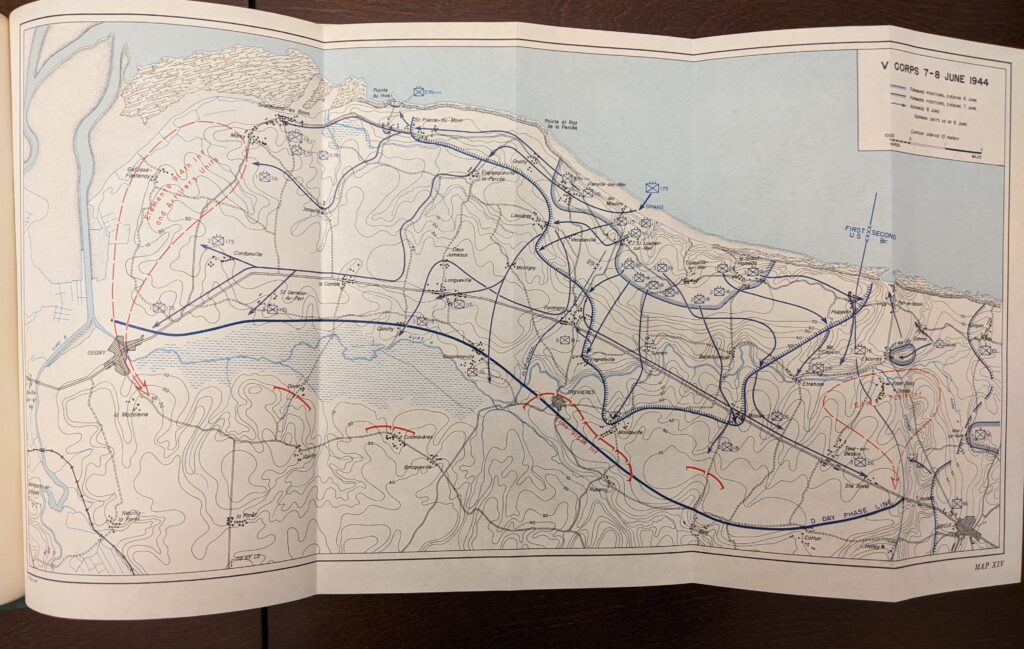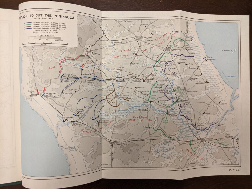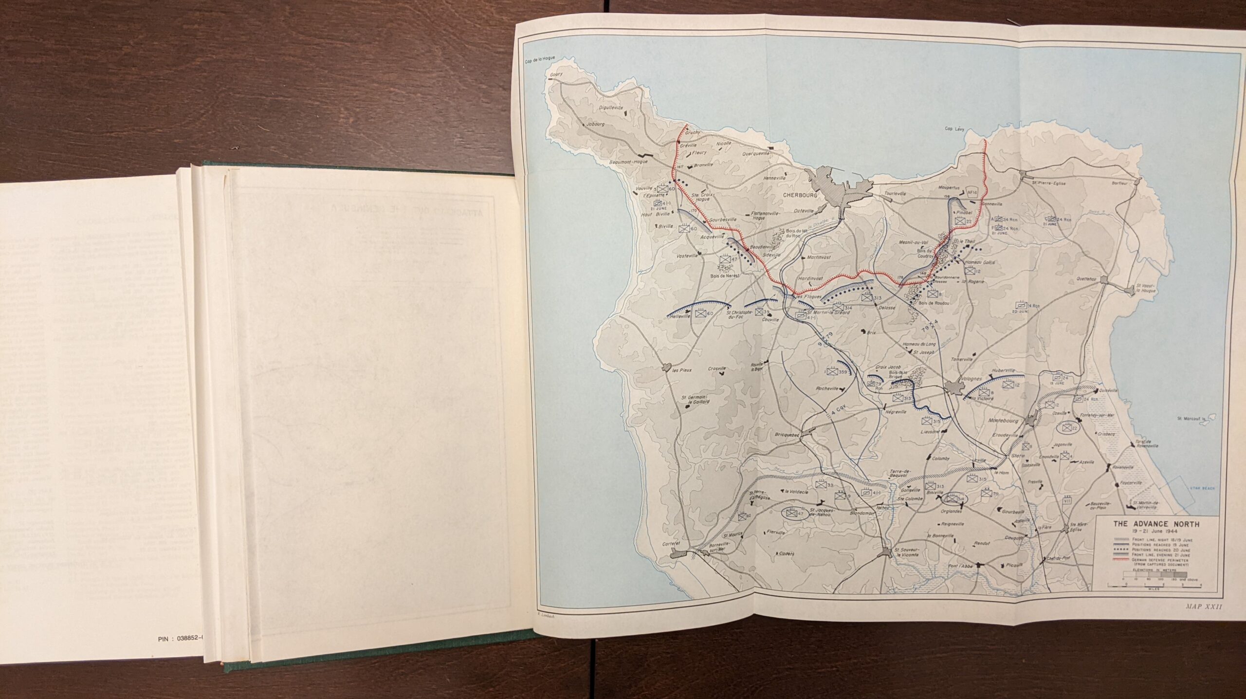
The other day, at a library book sale, I bought a couple cloth-bound volumes from the Army Center for Military History “Green Book” series. I was mainly interested in the dozens of foldout maps that each volume contains. The color foldouts allow for much richer detail than would be possible on a single monochrome page. In addition, each volume has maps in various sizes and shapes, customized to the subject. This allows the map to frame the subject in a way that really forces the reader to study the issue with new eyes. I am conscious of Michael Howard’s warning that battlefield maps can dangerously oversimplify deeply chaotic situations, but the number and variety of maps in these volumes are a great addition.
There are many other kinds of books, beyond military history and beyond general history, that could make greater use of foldout maps. And not just travel guides. They might add to the cost of the book, but foldout maps or charts would be a worthwhile addition to many books on international relations, economics, or geopolitics.