I have, for many years, been working on a biography of Alexander Macomb Mason. I won’t even try to begin relating his story here, but my research has given me a small collection of maps relating to his experience late in life as an officer on the Egyptian General Staff and an explorer in several parts of northeastern Africa. His two greatest achievements as an explorer and mapmaker derive from his 1874-1876 travels throughout Darfur and his accurate survey, in 1877, of Lake Albert which included “discovery” of the Semliki River. Mason appears as a minor character in many books from the period, but his name also appears on a number of historical maps.
There is a small collection of Mason’s papers in the Library of Congress, and some in the archives at Gunston Hall. There have been a few very brief profiles of Mason in magazines and newsletters but his full story has not yet been told.
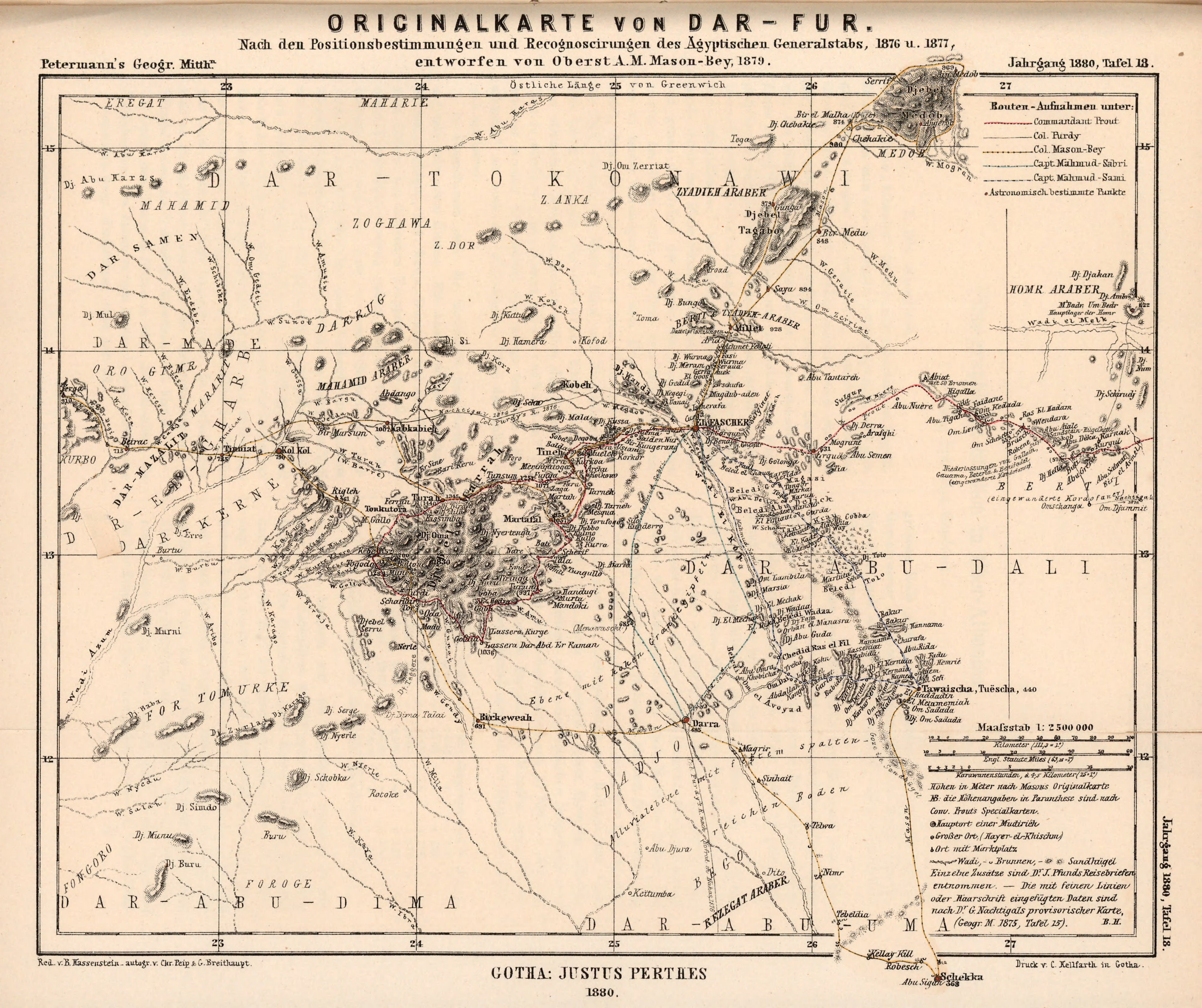
This map of Darfur, published in Germany around 1880, is derived from the Mason’s survey work and was the first accurate map of Darfur to be published. Mason, who reached the rank of Lieutenant in the Confederate Navy during the Civil War, became a Lieutenant-Colonel in the Egyptian Army and carried the honorific “Bey” throughout later life. On this German map he becomes “Oberst A.M. Mason-Bey.”
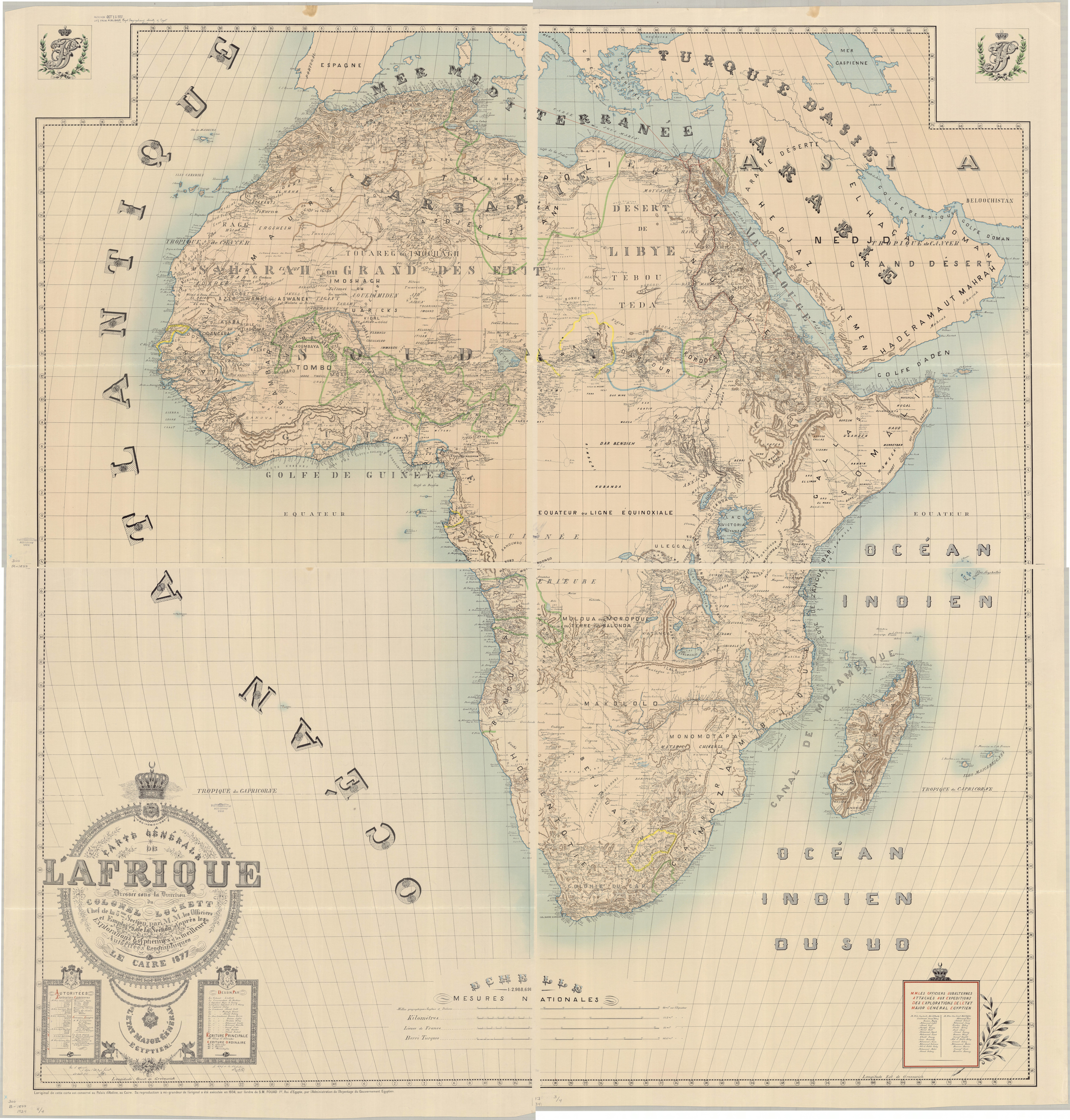
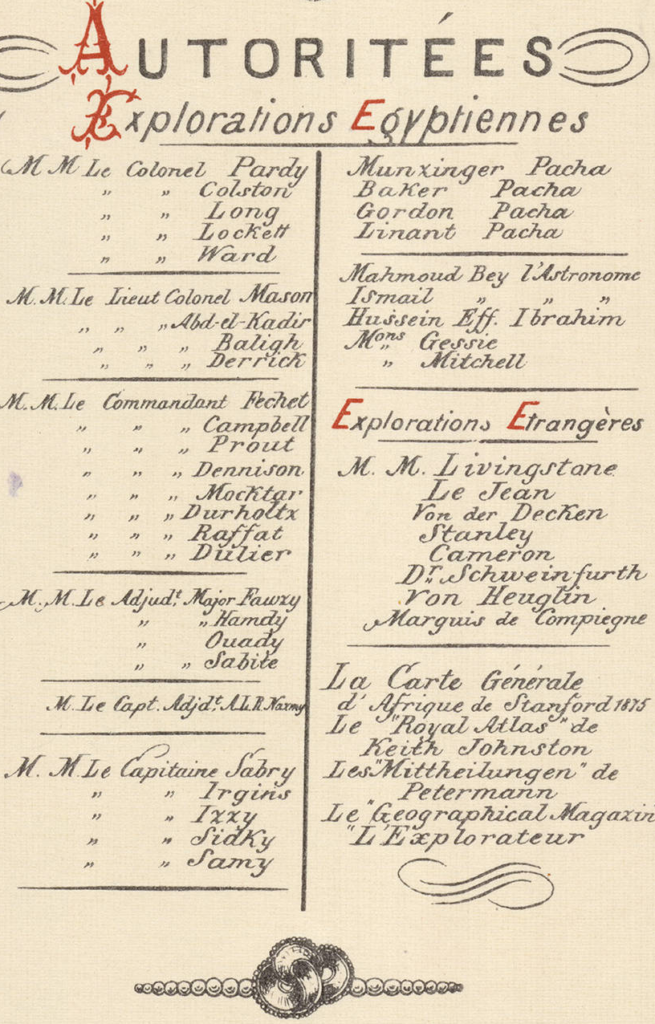
Mason’s friend Samuel Lockett, also a Confederate veteran who joined the Egyptian General Staff, produced this Carte Generale de l’Afrique based largely on the work of the American officers serving the Egyptian Khedive in the mid 1870s. The map was the Grand Prize at the Paris International Exhibiton of 1878. David Icenogle called this map “one of the great monuments of Victorian cartography” (The Map Collector, Spring 1989).
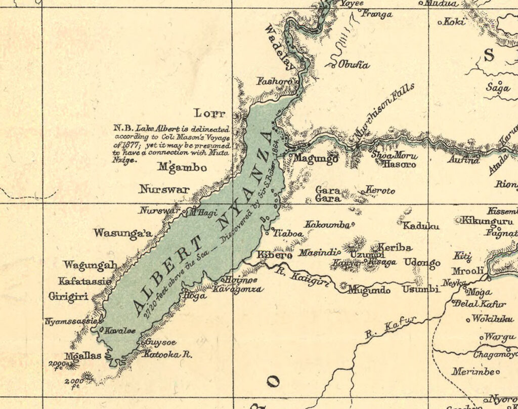
Henry Morton Stanley (of “Stanley and Livingstone” fame) indicated the results of Mason’s 1877 survey of Lake Albert on the foldout map included with Stanley’s 1878 book about his 1875-1877 expedition. Stanley later met Mason in Cairo in 1887 to discuss the geography of the region, carried Mason’s maps on the “Emin Pasha Relief Expedition,” and praised the accuracy of Mason’s work upon reaching Lake Albert in December 1887.
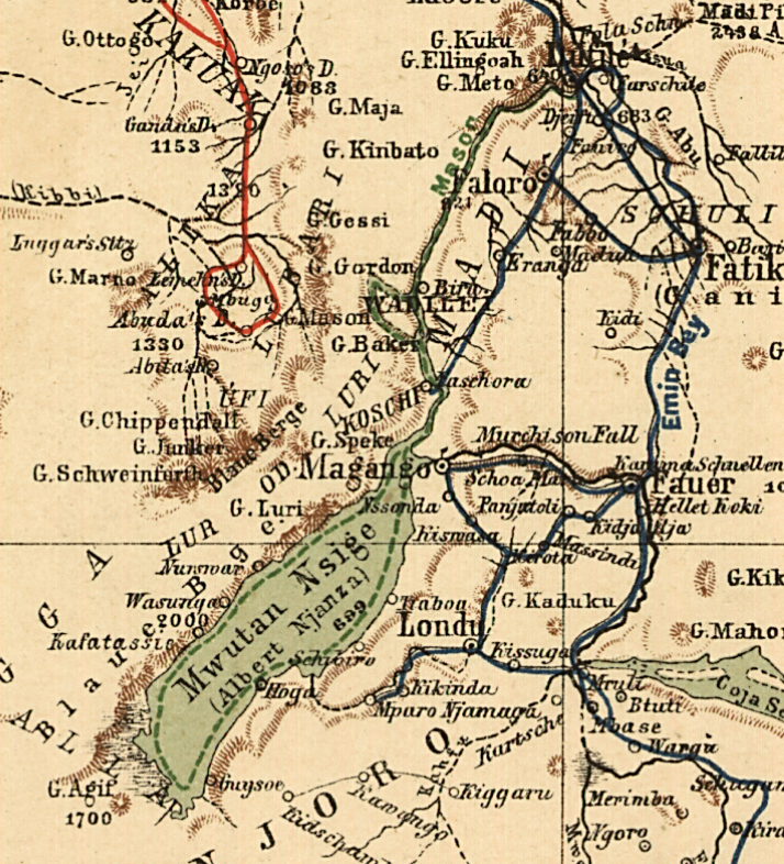
This 1885 map by Chavanne shows the path of Mason’s exploration up the Nile and around the circumference of Lake Albert aboard a small steamer as a dashed green line.