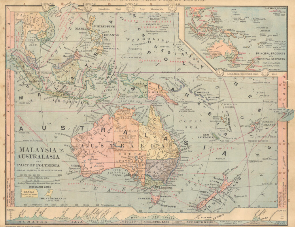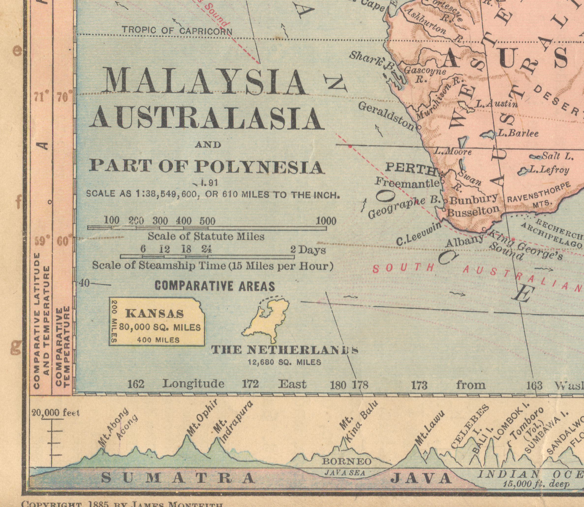
Some comparative area symbols make a lot of sense. There is logic behind James Monteith’s use of Kansas for its standard dimensions of 200×400 miles. And Jacques Redway’s use of Pennsylvania makes sense if most of the map users would be familiar with the shape and extent of that state.
What is less clear, to me, is the utility of using The Netherlands as a comparative area symbol, as Monteith did in this map of Australia, Southeast Asia. This is a rare instance of using two very different symbols. Monteith includes his standard Kansas symbol, but also adds a second symbol. Why add the Netherlands when few of his map users would have personal knowledge of Holland and it has very irregular dimensions?
Perhaps the irregular dimensions were the point? Was he trying to make a point about depicting and comparing area of regular and irregular shapes? Was he trying to emphasize comparative area over regions that are dominated by (or mostly) water– as in the case of both The Netherlands and Oceania? Or maybe the point was simply to compare the total area of the colonizing nation and the vast extent of what was then the Dutch East Indies? If so, I am not aware of other instances of Monteith making this geographic link between colony and colonizer.