Source: Emma Hart Willard and William C. Woodbridge, Modern School Geography, 1844.
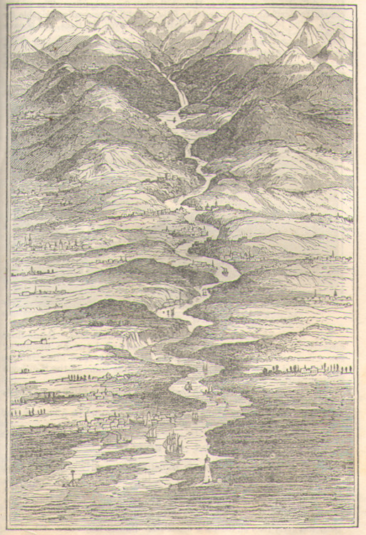
I was looking at my 1844 copy of Woodbridge and Willard and noticed a couple of diagrams I hadn’t noticed before. Both are reminders of just how innovative and how far ahead of their time they were with the illustrations on the tiny (4”x6”) pages of this book. I also suspect that their influence over James Monteith was even greater than I had previously realized. This stylized diagram of the phases of a river’s course, for example, looks like a likely inspiration for the much larger and more detailed Mississippi River illustration that Monteith produced a few decades later.
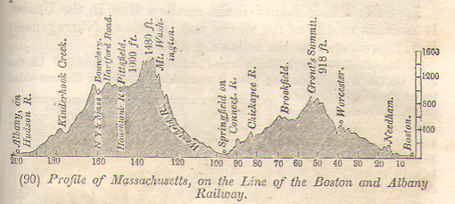
The other diagram I noticed was this profile of the state of Massachusetts. The vertical exaggeration makes this initially look like much more dramatic terrain than that of the Bay State. But there is some really great detail in here. And it is perhaps telling that the chosen line of the profile is that of the Boston to Albany railroad, rather than an arbitrary parallel of latitude.