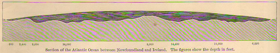
Source: James Monteith, New Physical Geography, 1885
Monteith, like so many of his contemporaries, made frequent use of terrain profiles of cross sections. Monteith, in particular, included many profiles of ocean depth in his geography textbooks. This one seems perhaps different in showing the curvature of the earth. The seabed between Newfoundland and Ireland was the key path on which the first transatlantic telegraph cables were laid.