My collection of James Monteith textbooks keeps growing. I keep finding subtle differences in the various editions, along with great new details of the comparative geography that he focused on, especially in his use of the margins. All of the images below come from a late edition of Monteith’s Comprehensive Geography, revised and reprinted some time in the early 1890s.
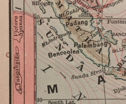
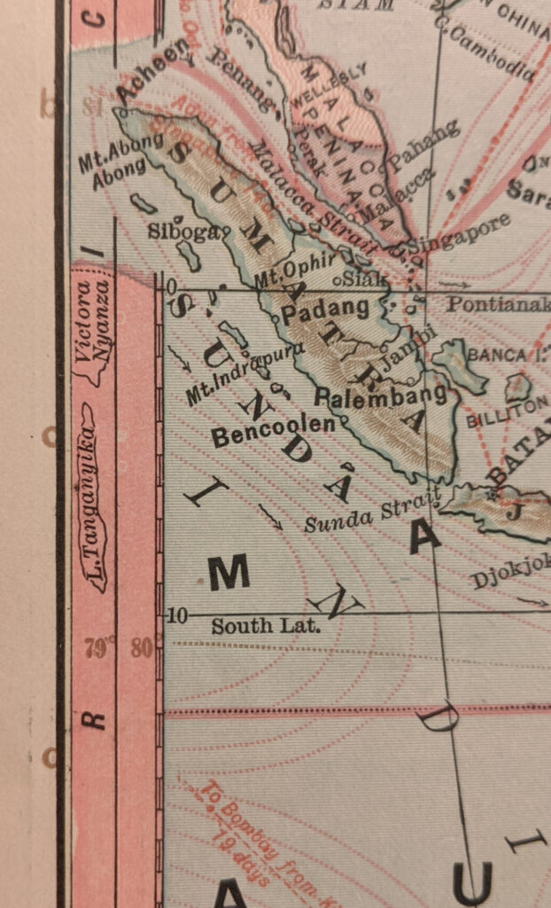
I have been intrigued by Monteith’s use of miniature representations of remote geographic features in the margins to mark comparative latitude. However, I had never before seen this one, which places Africa’s Great Lakes in the margins of a map of Oceania:
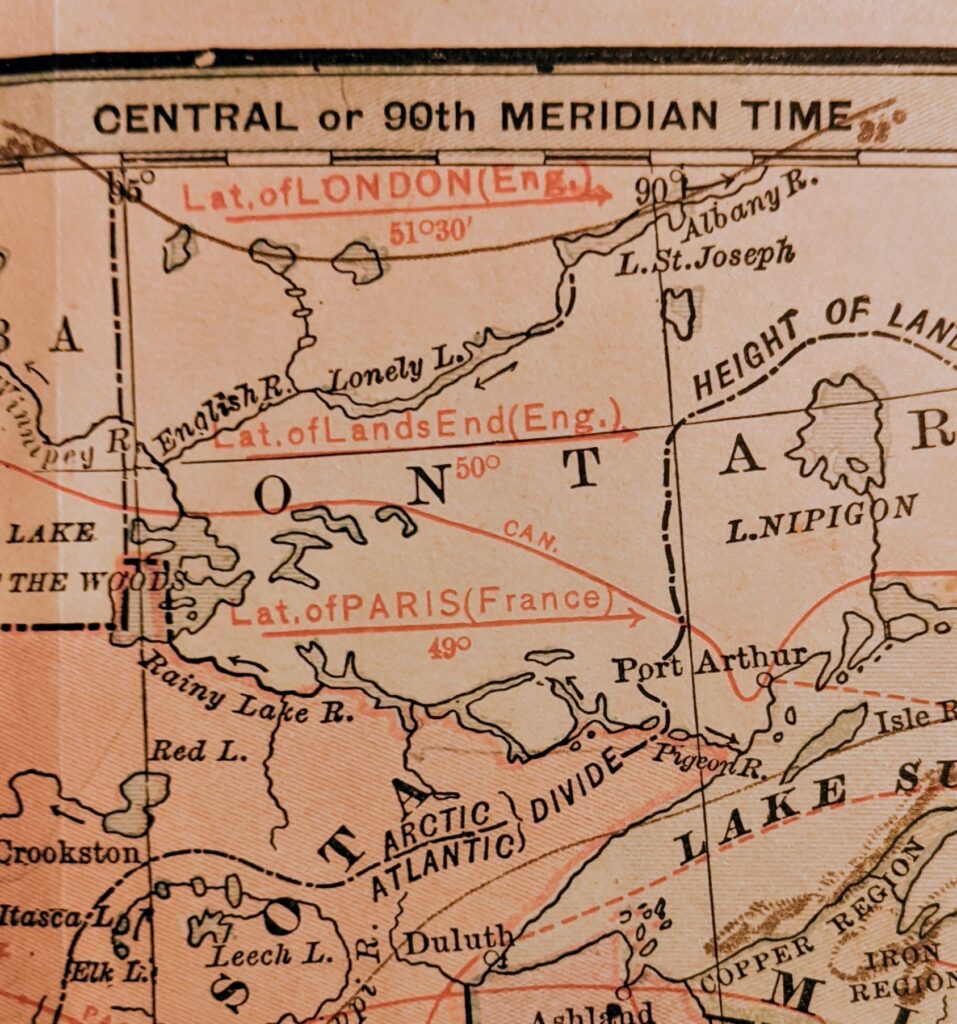
Monteith made great use of the margins to mark comparative latitude, including the stylized symbols above, points for remote cities, and bands of comparative extent. But I had not before found an example of placing a label and comparative latitude line in the body of the map itself. Here he places three abbreviated lines to show that southern Canada is at the same latitude as London, Land’s End, and Paris:
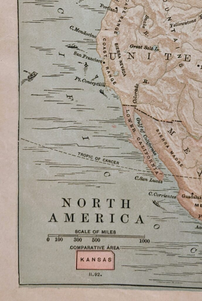
This map also jumped out at me, as I haven’t seen one quite like it in other Monteith textbooks. I love the colors, shading, and miniature ships plying the active trade routes of the period. And of course there is Monteith’s signature Kansas comparative area symbol: