Skip to content
Mapspam
  • Home
  • Posts
  • About Mapspam
  • Links
  • Simple Mapmaking Tools

Posts

  • Home
  • Posts
  • Page 3

Comparative Area in Invasion Planning

Posted by By Andy September 13, 2021Posted inMiscellaneous, Symbology, Uncategorized
This map, from the Matthews-Northrup Global Atlas of the World at War (1944), has an interesting connection between my interest in comparative area symbols and wartime strategic atlases. As an…
Read More
Jacques Redway and American Maps Getting Worse

Jacques Redway and American Maps Getting Worse

Posted by By Andy June 19, 2021Posted inGeography Textbooks, Symbology
I’ve written a couple of posts about Jacques Redway, and I remain intrigued about what the full story of his life and work might contain. But as I collect more…
Read More

Alexander Macomb Mason: Maps from 1870s Explorations of Darfur and Lake Albert

Posted by By Andy May 26, 2021Posted inAfrica, Miscellaneous
I have, for many years, been working on a biography of Alexander Macomb Mason. I won’t even try to begin relating his story here, but my research has given me…
Read More
Netherlands area symbol

Two very different comparative area symbols

Posted by By Andy April 1, 2021Posted inAsia, Geography Textbooks, Symbology
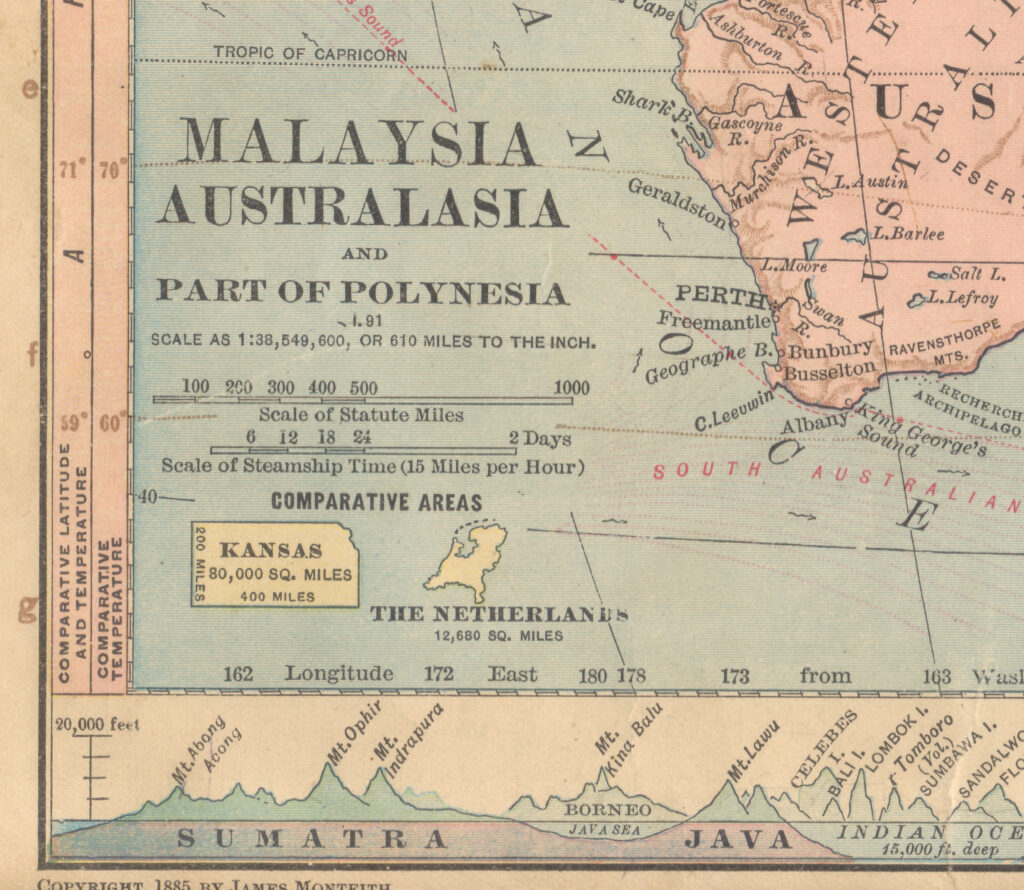
Some comparative area symbols make a lot of sense. There is logic behind James Monteith's use of Kansas for its standard dimensions of 200x400 miles. And Jacques Redway's use of…
Read More

Posts pagination

Previous page 1 2 3 4 5 6 Next page
Recent Posts
  • Classic 1925 French Globe by G. Thomas of Paris
  • Rafael Palacios– Update and Forthcoming Article
  • Rafael D. Palacios (1905-1993)
  • The World Needs More Foldout Maps
  • Jacques Redway on the History of European Discovery
  • Fresh Look at Willard and Woodbridge
  • Profile of the North Atlantic (1885)
  • New Monteith Details
  • Comparative Area in Invasion Planning
  • Jacques Redway and American Maps Getting Worse
Scroll to Top